920
26
Inspired by the geography game GeoGuessr, Alan Taylor, who runs theatlantic.com’s wildly popular In Focus, spent some time recently in Google Maps, finding the edges of their Street View coverage. Harnessing the power of Google Maps Street View, Taylor takes us for a virtual ride around the world to some of these very locations.

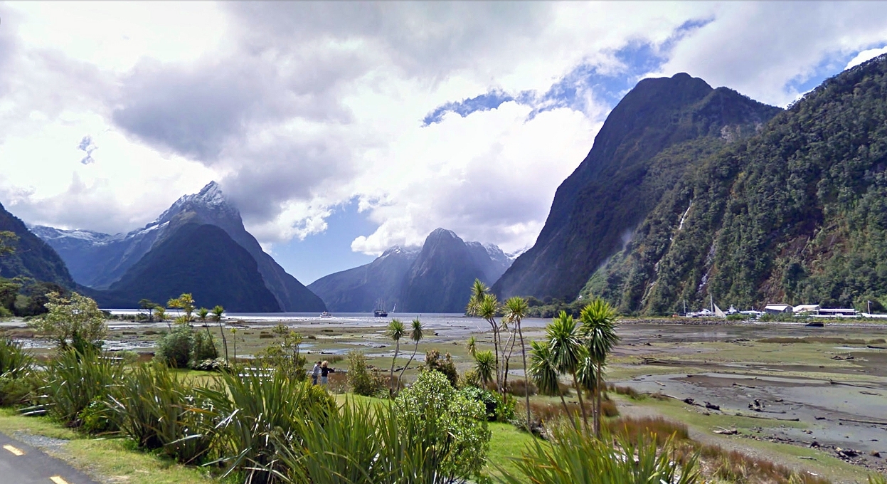
At the end of the Milford Sound Highway, in Southland, New Zealand, part of Fiordland National Park.

Kaimu-Chain of Craters Road, Hawaii. Past eruptions of the Kilauea volcano have covered the road in several places.


Sha Tau Kok crossing, New Territories, Hong Kong. This crossing marks the entry into the Frontier Closed Area, a tightly controlled buffer zone between Hong Kong and mainland China.


Massive sculptures of U.S. presidents, in the lot of SculpturWorx, at the end of Summer Street in Houston, Texas.

The rocks of El Arco de Cabo San Lucas, viewed between buildings in Cabo San Lucas, at the southern tip of Baja California, Mexico.


As far north as the van was allowed to drive in Alaska. A BP checkpoint, on Spine Road, Prudhoe Bay, Alaska. Construction facilities are visible in the distance at upper right.

The Buckner Building, a massive WWII-era abandoned structure in the tiny port town of Whittier, Alaska.

Lagoa Azul, part of a twin-lake complex situated in the crater of a massive volcano on the island of Sao Miguel, Azores.

Canada to the left, United States to the right, on Henderson Road, British Columbia. The road turns left just ahead, the line cut through the trees at center marks the international border.

A CBC News camera operator at work on the U.S.-Canada border. Gladwyn Road, in British Columbia, dead-ends at the border, the trees in the background are on U.S. soil.


A bust of Vladimir Lenin in Pyramiden, a former Soviet-run coal mining facility, now abandoned in Svalbard.

One of the easternmost points along Brazil's Atlantic shoreline (at least as far as Google's Street View team have covered), Avenida Beira Mar, in the town of Paulista.


A view of the Chilkat Range, across Lynn Canal from the borough of Juneau, Alaska, about as far north of the city as one can drive. The capital city has a small road system, but is not connected to any outside roads -- the only way in or out is by air or by sea.


Source:
реклама


