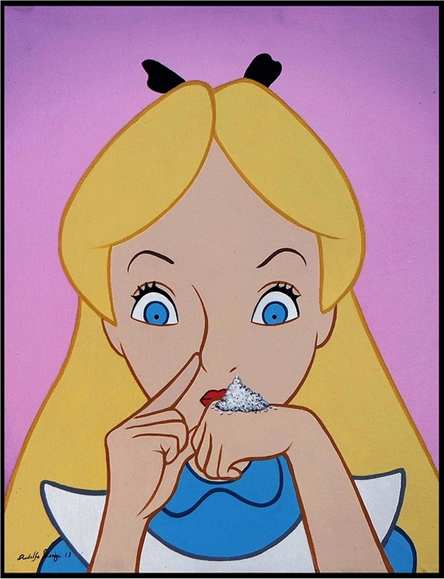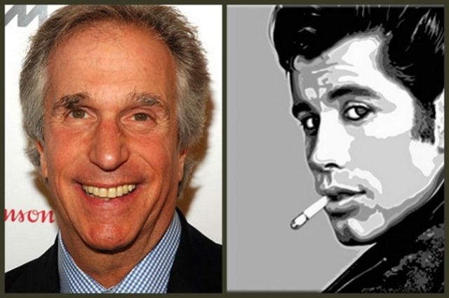


DisHollywood is an upcoming solo art show by artist José Rodolfo Loaiza Ontiveros at the La Luz De Jesus Gallery in Los Angeles featuring José ‘s “latest visual project which attempts to re-mix beloved characters from Disney fairy tales with other entertainment icons from the world of cinema, celebrity and music.” The art show will open on Friday, August 2, 2013 from 8-11 PM and be on display until Sunday, September 1st. You can view more previews online at the La Luz De Jesus Gallery and Hi-Fructose Magazine websites.


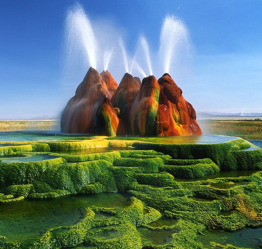
The Fly Geyser, also known as Fly Ranch Geyser, is a small man-made geothermal geyser, located in Washoe County, Nevada, and besides spitting water up to 5 feet into the air, it strikes you with beautiful vibrant colors, making the whole landscape look like a painting. The geyser actually developed by mistake from a leaking geothermal well, which was first drilled back in 1916. Sometime in the 1960s the geothermally heated water found a crack and erupted. It has been spewing gushes of hot water ever since. The colored rock itself has been growing and forming from the dissolved minerals, which continue accumulating and thus shape the travertine mound around the geyser. The beautiful colors form due to the thermophilic algae. As the geyser is located on a private ranch and has its owner, it’s hidden from the viewers behind a high fence and a locked gate with spikes on top of it.

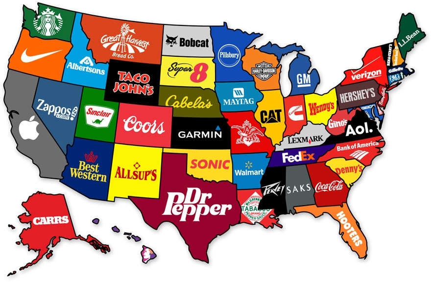
By the time we graduate high school, we learn that they never taught us the most interesting things in there. Sure, you might be able to name the European countries or point New York on the map, but does that give a you real understanding of how the world functions? To fill this gap, we have gathered a great and informative selection of infographical maps that they should’ve shown us at school: every single one of these maps reveals different fun and interesting facts, which can actually help you draw some pretty interesting conclusions. What makes infographical maps so engaging is how easy it becomes to conceive graphically presented information. The best part, there are brilliant services like Target Map that “allow everyone (from individuals to large organizations) to represent their data on maps of any country in the world and to share their knowledge with the whole Internet Community.” Just choose a country and a way to create your map by color, type values or by uploading your excel files (you can even use your zip / postal code column to get the best and most accurate maps. Without further ado, we invite you to learn things like most popular sports in different countries, who has the largest breasts, red hair map of Europe, world’s most consumed alcoholic beverages, or which brands dominate in different states of the USA. Trust us, these are way better than the ones they taught you at school!














![The Indoor Cloud: a Breakthrough Designs Interior [video] The Indoor Cloud: a Breakthrough Designs Interior [video]](https://tn.fishki.net/26/upload/en/201308/02/12454/c3ee0183ca455cdbff97b43f41e87767.jpg)
![Turtle smokes 10 cigarettes a day [video] Turtle smokes 10 cigarettes a day [video]](https://tn.fishki.net/26/upload/en/201308/02/12453/4d1bf5afb2dd7636dfc6f2e9723b40fb.jpg)
![Laser cigarette lighter [video] Laser cigarette lighter [video]](https://tn.fishki.net/26/upload/en/201308/02/12452/af8e76cefa12bd780a393092d593f0ef.png)

